Picture This: A Tectonic Revolution
It has now been more than 160 years since Charles Darwin and Alfred Russell Wallace laid the keystone of modern biology with the theory of evolution. But geology—Darwin’s original field of study—would wait almost another full century, until the 1950s, for the first light of its new dawn. As evolutionary theory revolutionized biology, the theory of plate tectonics brought geology into the modern era and did away with the comforting fiction of the eternal, unchanging Earth once and for all. From then on, everything—from the distribution of earthquakes and volcanoes around the globe to the heights of the Himalayas and parallel peaks and valleys of the American Basin and Range—could be explained as facets of the same underlying theory. The planet finally began to make sense: the Earth’s outermost rocky layer, the lithosphere, is not a solid shell, but a jigsaw of rocky plates adrift over an ocean of hot rock with the consistency of silly putty. Where warm material rises from this viscous part of the mantle, plates tear apart, and new land forms as lava pours forth from the ruptured crust. Where plates collide, they thrust up new mountain ranges and drive cold, dense oceanic crust back down into the mantle. It is a ceaseless cycle of creation and destruction; every few hundred million years, each rock on the seafloor will have been replaced and the contours of the continents redrawn.
Geology waited a long time for its revolution. But if not for one map—and the remarkable woman who created it—earth science would have had to wait even longer still.
Oceanographer Marie Tharp’s 1957 map of the North Atlantic turned geology upside down by revealing the topography of the seafloor, which until then scientists had largely assumed was a flat, featureless abyss. Tharp’s survey is cut through by twin chains of drowned volcanoes that rise along the banks of a rift valley rivaling the Grand Canyon in width and depth, but that stretches from Greenland to the edge of the Antarctic. This is the Mid-Atlantic Ridge, a long mountain range and rift valley that we now understand as the violent border marches of the great tectonic plates on either side of the Atlantic.
Tharp’s first map revealed only one section of this underwater topography, which she and her colleagues discovered was just one part of a larger system of mid-ocean ridges encircling the globe. Between 1952 and 1977, Tharp and her colleague Bruce Heezen would go on to chart the entire seafloor, revealing this world-spanning ridge in its entirety for the first time and connecting it to rift valleys on land like the East African Rift. However, the 1957 North Atlantic section was enough, eventually, to convince geologists to entertain the possibility that the continents were moving—a controversial idea that for decades had been widely dismissed as scientific hocus pocus. The Plate Tectonic Revolution had begun.
The polymath skillset that made Tharp such a unique and important mapmaker was very much a product of her place and time. Had she been born a few decades later, she might have gone directly into science. She grew up following her father, a soil surveyor for the USDA, across the country and developed an early interest in geology. But in college, she studied fine arts; women were not welcome in technical fields. Intellectually restless, she flitted between majors and ended up graduating with degrees in English and Music and four minors, including one in geology. She also learned technical drawing. Tharp thought she’d ultimately become a teacher, like her mother. But in 1941, Japan bombed American ships at Pearl Harbor and the US declared war in return. With so many young men gone to fight in World War II, institutions that had previously shunned women suddenly competed to recruit them. The University of Michigan, which had previously only admitted men to its geology program, put up flyers at other colleges advertising a geology master’s degree program for women, and Tharp applied. She graduated in 1944 and earned another bachelor’s degree in mathematics in 1948.
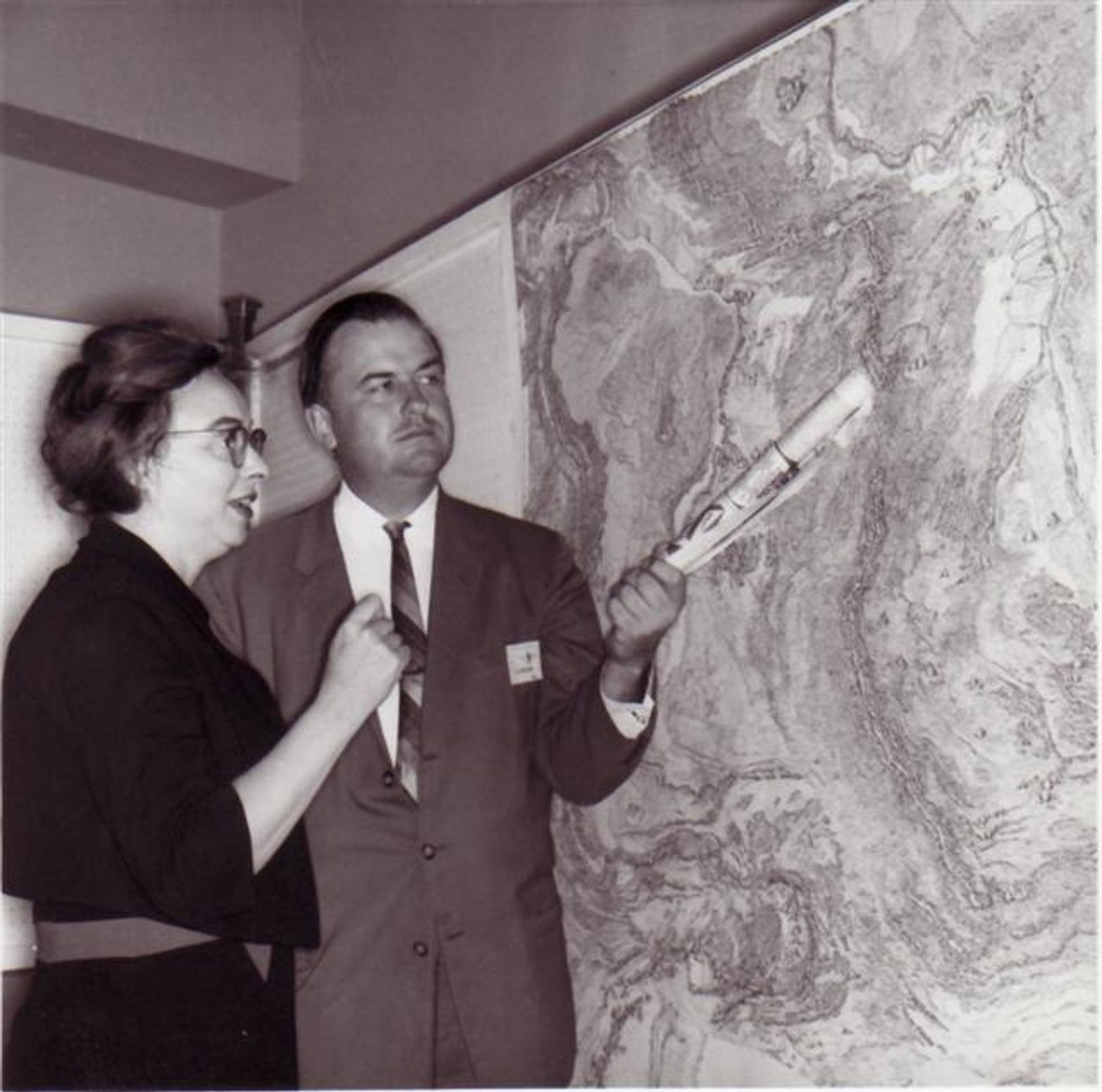
That year, she moved to New York and went looking for work. After the tedium of cleaning fossils dissuaded her from applying to jobs at the American Museum of Natural History, Tharp decided to try Columbia. Her math degree earned her an introduction to Maurice Ewing, a geophysicist and founder of Columbia’s fledgling Lamont-Doherty Earth Observatory. But it was her drafting skills that got her the job. Ewing—who colleagues at Lamont just called “Doc”—was gearing up to chart the Mid-Atlantic Ridge, and he needed a cartographer.
A mysterious underwater rise had been discovered halfway across the North Atlantic in the 1850s when sailors aboard the USS Dolphin dropped cannon balls tied to ropes overboard to sound the depths. In 1872, the HMS Challenger expedition discovered a similar ridge in the South Atlantic. But for decades, that’s about all scientists knew. The only way we could chart the seafloor was by throwing heavy things downward. Everything that lay beneath a few miles of water might as well have been on the moon.
Then, in 1912, the Titanic met its icy end in the North Atlantic. This major world-historical event had the accidental effect of catapulting seafloor exploration into a new age. Just a few months after the disaster, English polymath and pacifist Lewis Fry Richardson filed a patent for a device that could detect underwater icebergs using sound pulses. Other engineers quickly followed suit and developed new and more powerful ways to “see” by listening. World War I submarine warfare drove acoustic research to new heights, and when peace returned, improved echo sounders were put to alternative use seeking routes for transatlantic telegraph cables—and, eventually, charting the depths. By the 1920s, researchers were increasingly convinced that the Mid-Atlantic Ridge was real, and that it might run up and down the entire Atlantic—a fact that was eventually confirmed by the German Meteor expedition, a scientific mission between 1925 and 1927. But despite this progress, by the 1950s no one had managed to translate these first echoes of the Earth’s drowned landscapes into a full picture.
In 1948, Ewing bestowed that enormous task to a young grad student named Bruce Heezen. Heezen needed someone who could transmute reams of echo sounder measurements into accurate diagrams of the seafloor topography, and Tharp quickly proved herself up to the job. Tharp was unable to accompany Heezen out to sea, as women were not allowed on research vessels. So, she stayed behind at Lamont, processing data. In 1952, she noticed something unexpected: a V-shaped indentation right at the center of the Mid-Atlantic Ridge.
A trained geologist, Tharp knew immediately what she was looking at. It was a rift valley—a dip in the Earth formed as its surface pulls apart.
At first, Heezen dismissed Tharp’s interpretation as impossible “girl talk.” If the Earth’s surface was pulling apart from the Mid-Atlantic Ridge, the continents on either side of the Atlantic would presumably be drifting apart—and continental drift was, at the time, tantamount to scientific heresy. But Tharp was confident she was right and Heezen came around eventually. In 1952, he had her begin work on a full map of the North Atlantic seafloor. In parallel, Heezen hired a graduate student to plot the epicenters of undersea earthquakes on a map of the same scale as Tharp’s. With the two maps layered over each other on a light table, the earthquake epicenters ran right down Tharp’s V-shaped valley. Further expeditions revealed that the Mid-Atlantic Ridge extended into the Indian Ocean and into the East African Rift on land, and Heezen concluded that the Atlantic ridge must be just one arm of an enormous, 40,000-mile rift system spanning the entire globe.
When Heezen first presented this result in 1956, he was met with a mix of enthusiasm and disdain. Years later, researchers were still arguing over whether the rift valley was real and if it was evidence for continental drift. Tharp let them fight. “I was so busy making maps, I let them argue,” she recalled in 1996. At the time, she was hard at work turning Heezen’s data into a physiographic map, which would show the Mid-Atlantic Ridge as if viewed from a low-flying plane. “I figured I’d show them a picture of where the rift valley was.” In 1957, she did just that. It took a little over a decade from there to work out the details of plate tectonic theory and for critics to finally come around. It took even longer for Tharp, a rare woman in science working in the deeply sexist 1950s, to receive credit for her contribution to the revolution.
Today, Tharp’s groundbreaking maps of the seafloor have attracted the attention they deserve—though I’m not sure that’s true for plate tectonics itself. When I studied geosciences at Caltech in the 2010s, it was not presented to me as any kind of revolution. In physics and biology courses, we took time to appreciate the history and significance of paradigm-shifting ideas like Boltzmann’s statistical mechanics and, of course, Darwin’s theory of evolution. I was taught about plate tectonics, but I can’t recall ever sitting through an enthusiastic lecture on the Plate Tectonics Revolution. I suspect this has to do with the startling newness of it all: while biologists have had more than a century and a half to work with evolution, plate tectonics has been accepted for less than 60 years.
It was only when I became interested in the origins of life and the possibility of finding it elsewhere in the universe that I started to understand the significance of Tharp’s discovery. I assumed, when I learned geology, that plate tectonics was simply what planets did. But in fact, Earth’s geology is downright weird—perhaps even one of a kind. No other world in our solar system has plate tectonics. And this one difference can explain so much about why our world is, in so many respects, a world apart.
Plate tectonics is why many of the rocks most common on Earth’s surface are vanishingly rare everywhere else. Granite, the most abundant component of Earth’s continents, is practically nonexistent in space; producing it involves melting and re-solidifying rock over and over again, which is hard to do without plate tectonics. That’s why researchers were so surprised when, in 2023, they discovered a patch of granite lurking on the Moon (we still aren't sure how it got there). Plate tectonics is why you’ll find white quartz sand on Earth but practically nowhere else, and why Mercury, Venus, and Mars don’t have continents.
The churn of the plates may even be the reason why our planet can host life. Many researchers believe that Earth could not have remained habitable over geologic time if not for plate tectonics; constantly recycling the crust regulates Earth’s carbon cycle over millions of years and prevents climate runaway. Our oceans’ fertility depends on nutrients that erode from the continents. Plate collisions likely raised the continents in the first place, and today they continuously thrust fresh rock up above the sea. Were the plates to halt, the continents would grind down over time to flat sheets, effectively ending erosion and starving the seas of nutrients. Of course, we don’t know if life on Earth would have been impossible without plate tectonics. The origin of life on Earth is still a hotly debated mystery—as is the onset of plate tectonics. Both happened so long ago that the rocks that might have borne witness to these pivotal events no longer exist.
We might be able to glimpse aspects of Earth’s lost past in the present time of other worlds. Researchers study Jupiter’s volcanic moon Io and its alien tectonics as a possible analogue of the early Earth, before its crust broke into plates. Looking further afield to exoplanets, one day we may discover more direct parallels to Earth. It’s early days for exoplanet geology. With the James Webb Space Telescope, researchers can now glean a few precious facts about the rocky surfaces of worlds orbiting a particular class of dim star. We can measure their temperatures and begin determining what covers the surfaces of other airless, “bare rock” exoplanets. One day, it might be possible to search for evidence of alien plate tectonics and ask whether habitable conditions depend on the phenomenon.
In a way, we’re still in the nineteenth century, dropping roped-up balls into the sea to find out where the water ends. Space telescopes purpose-built for hunting habitable worlds won't arrive for a few decades. But when they do, they will allow us to directly view light from Earth-like planets around sun-like stars for the first time. We will get our first pictures, however fuzzy, of alien earths. And as Marie Tharp’s incredible maps show, the right picture can be a revolution in itself. ♦
Subscribe to Broadcast